July 3, 2024
Written by: Acacia Markov, PhD Candidate, Lab MAREE
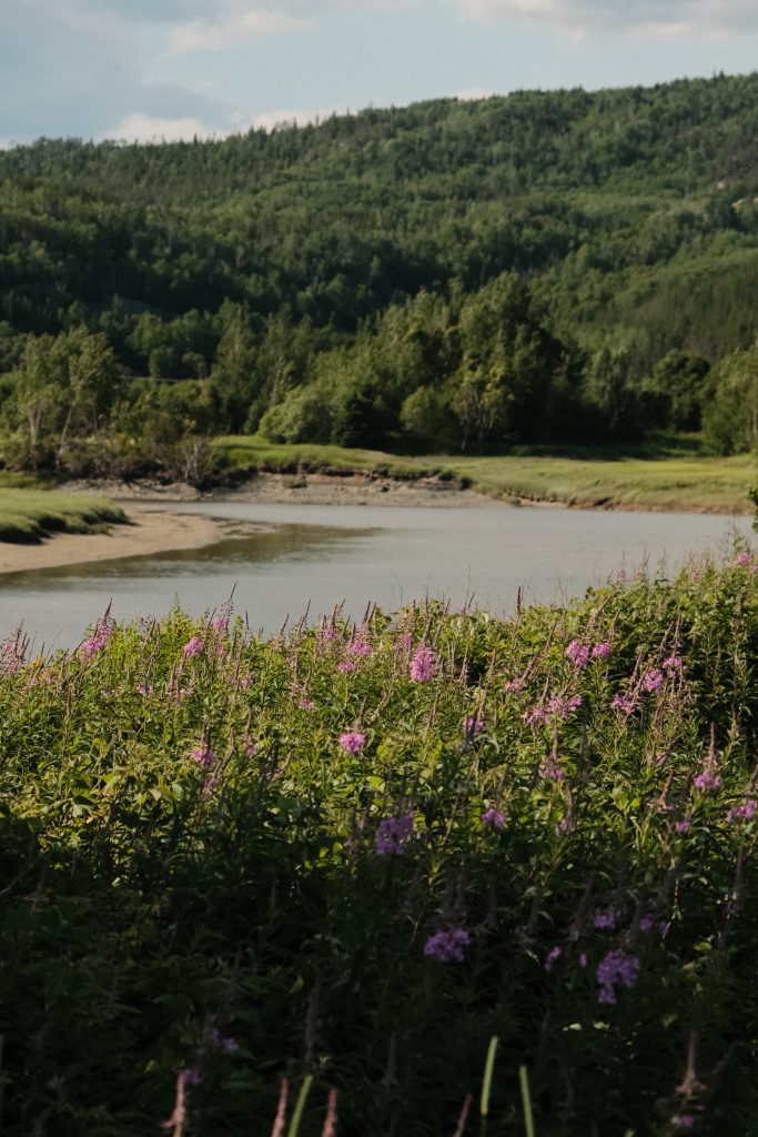
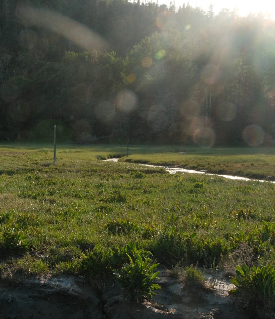
Another summer commences with monthly outings to the marshes of the Petites-Bergeronnes River, Quebec; located just east of the Saguenay Fjord, and about a four-hour drive for our field team travelling from the Lab MAREE home-base in Quebec City. This project started just last year, with the first visit to the marsh in July 2023. Since this first trip, our field team has been back five times to enjoy the beautiful landscape, but mostly to collect critical data that can help us understand how the marsh has, and will continue to, evolve. More specifically, we’re interested in saltmarsh “hydro-eco-geomorphic” evolution. Let’s break this down.
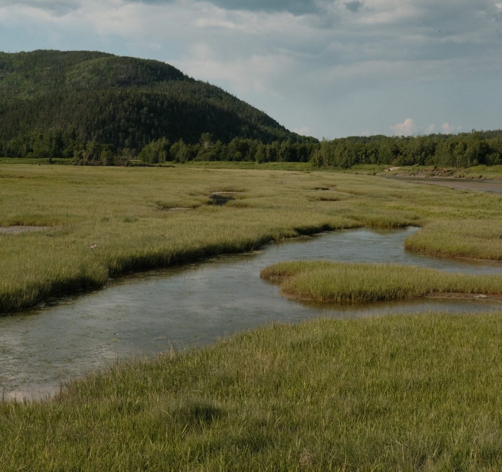
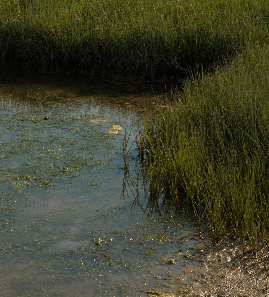
Saltmarshes are intertidal grasslands, that often form in estuaries or other areas protected from large waves. They are comprised of salt-tolerant species, within which species distribution is strongly tied to elevation within the tidal frame, as this dictates saltwater flood duration. Species with a higher flood (and salt) tolerance will dominate the lower elevation zones of saltmarsh environments. These “pioneer species” can begin to expand as sediment accumulates on the tidal flat, bringing the elevation within its tolerable range. Similarly, as sediment accumulates within the marsh, changes in elevation may yield more favourable conditions for a different marsh plant, triggering a vegetation species transition.
Saltmarshes can provide us with numerous ecosystem services, including carbon capture and coastal protection, both particularly important in the face of climate change. Ensuring that we can maintain access to these benefits means understanding how these systems may change over time.
When we talk about saltmarsh “hydro-eco-geomorphic” evolution, we are looking at the overall change in saltmarsh properties (elevation, extent and plant species composition) as a result of the interactions between hydrodynamic systems, ecological systems, and geomorphic systems:
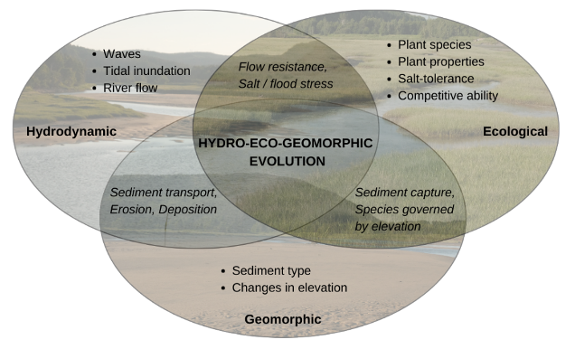
Without consideration of the interactions between all of these systems, our ability to reconstruct past changes, and increasingly more important, predict future changes in saltmarsh environments are limited. This has consequences for risk assessment and restoration design.
Consider the former – how can we predict how a marsh will change when faced with sea level rise? Will it expand or drown? How can we predict the impacts on a saltmarsh system if we build infrastructure in proximity? For the latter – without predictive tools, development of saltmarsh restoration design requires long-term monitoring of existing restoration projects and does not evaluate how different restoration plans could play out at a single site. Thus, predicting the outcomes of different design schemes before implementation could be crucial for improving restoration success.
So how does this relate to our outings to the Petites-Bergeronnes marshes?
This site will act as a case study for the development of the first coupled hydro-eco-geomorphic model of saltmarsh evolution in Canada. In order to develop such a model, we need to collect field data to support a comprehensive characterization of each of the above-mentioned systems.
On the right: High marsh vegetation (multiple species)
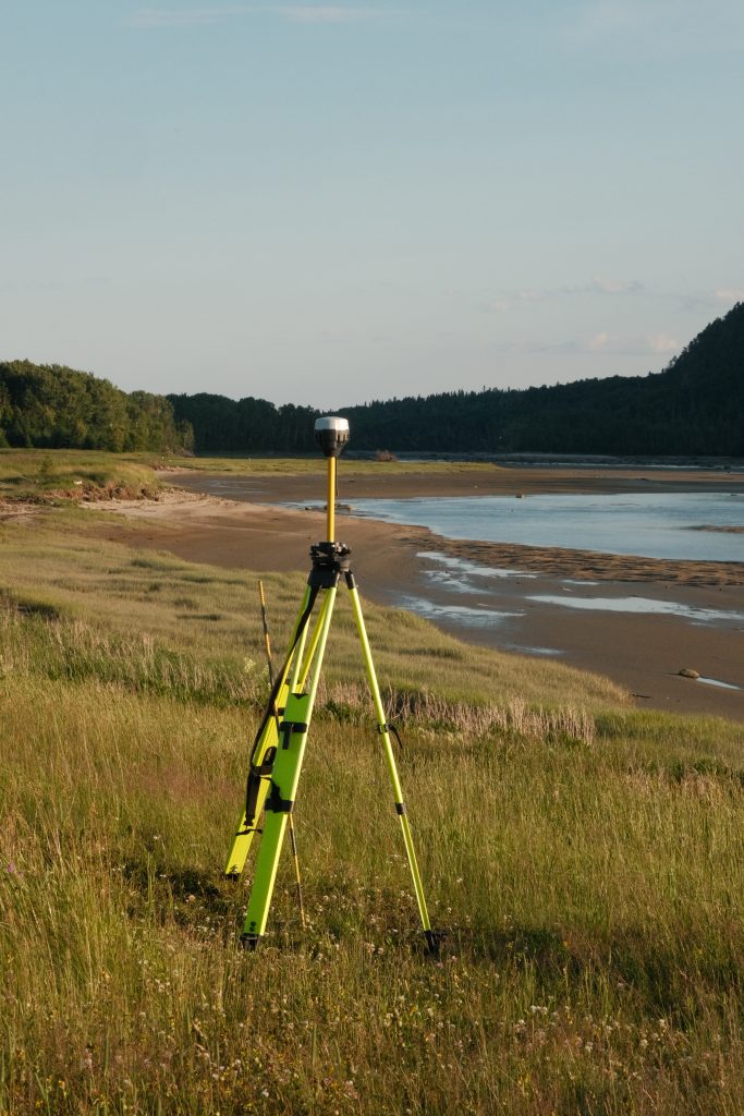
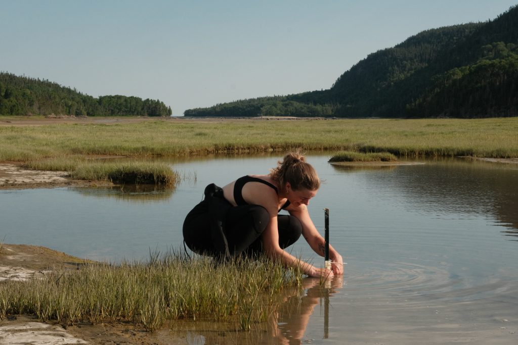
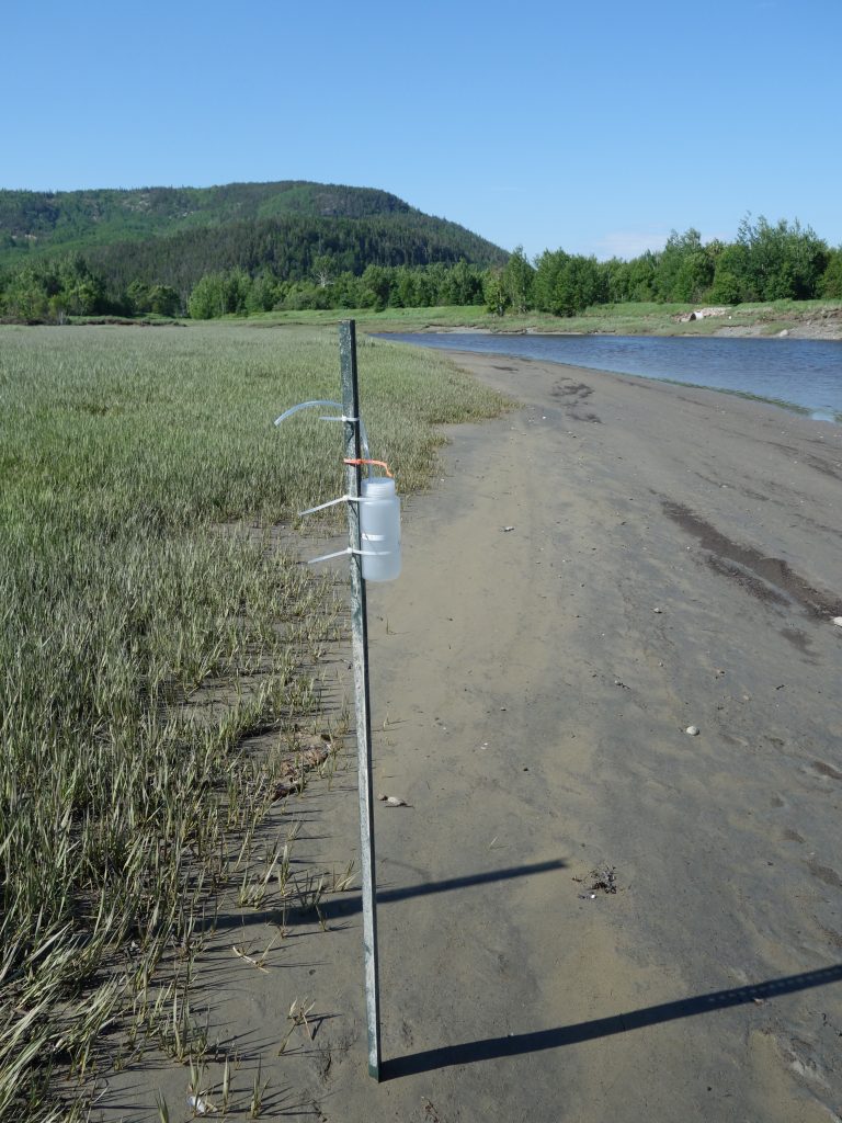
During the open-water periods of July 2023 – present, our team has deployed several hydrodynamic instruments (pressure sensors, current meter, accelerometers) that allow us to monitor tidal dynamics, marsh vegetation inundation, and river velocities during tidal flood and ebb flows (“Hydro-“).
Surveys of the different marsh vegetation on-site have also been conducted throughout 2023 and 2024. Dominant plants of the Petites-Bergeronnes marshes include the pioneer species Sporobolus alterniflorus, and a mixture in the high marsh of Sporobolus pumilus, Limonium carolinianum, Lysimachia maritima, Potentilla anserina, and Salicornia depressa (“Eco-“).
We are also monitoring metrics of sediment transport, including suspended sediment concentration in tidal floodwaters (sediment supply to the marsh), and monthly sediment deposition rates throughout different areas of interest (pioneer zone, high marsh) (“Geomorphic”).
This covers our three main systems, however, the Petites-Bergeronnes marshes undergo significant change throughout the growing season. Completely covered in ice during the winter, the perennial saltmarsh species re-establish themselves in May, and evolve through their growth cycle until seasonal die-off in late Fall. Consequently, plant properties have been collected for the dominant species throughout the growing season (presently, July and September 2023, May and June 2024), so that our team can also investigate the influence of these seasonal changes on the results of numerical predictive saltmarsh tools.
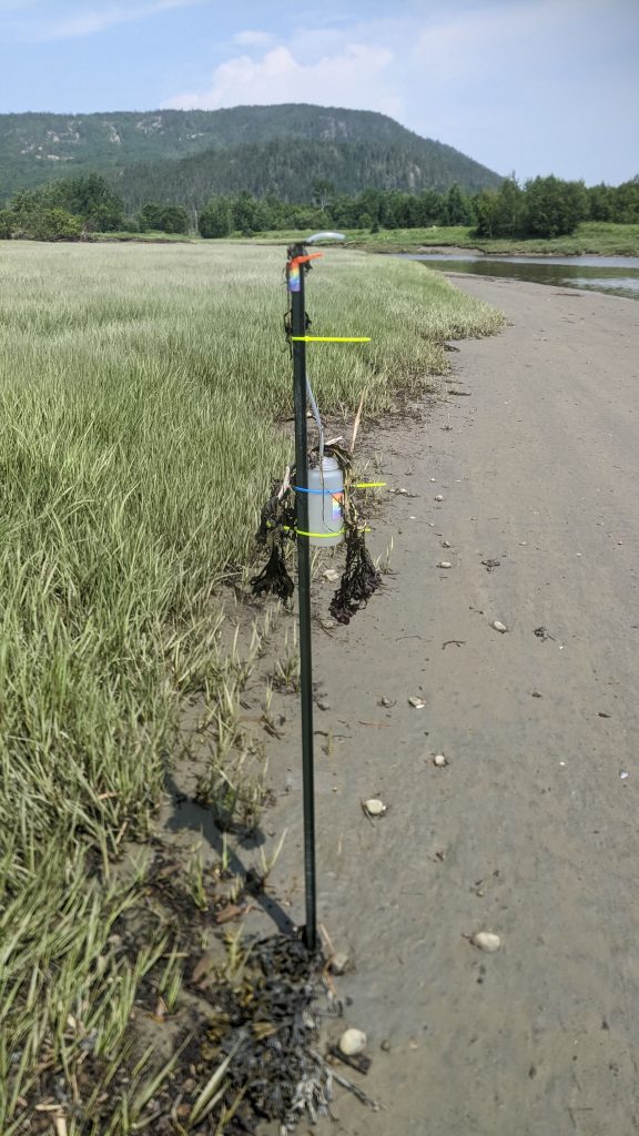
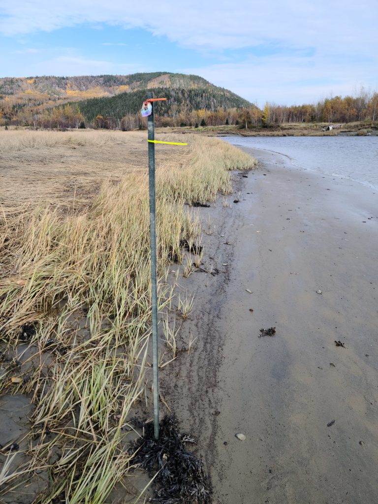
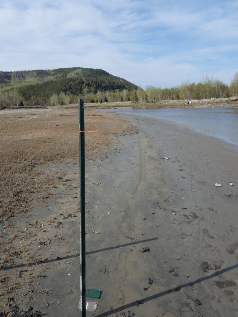
From left to right: July 2023, October 2023, May 2024, June 2024
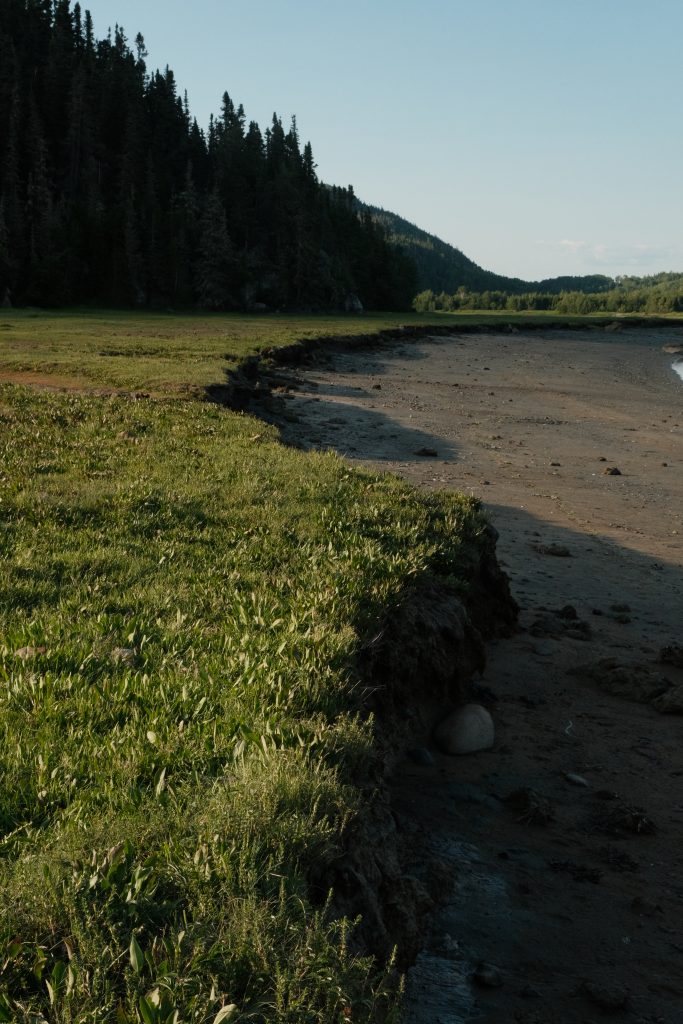
Piecing all of this data together, we start to develop an understanding of the Petites-Bergeronnes saltmarsh system. We see some areas with healthy pioneer vegetation, high sediment supply, and frequent tidal flooding, all pointing towards expansion. However, we also see some sections of the marsh elevated, with no pioneer vegetation and minimal sediment supply, actively eroding into the Petites-Bergeronnes River.
So, are the saltmarshes gaining ground or losing it? In fact, we see both at the Petites-Bergeronnes marshes, providing us with a great opportunity as modellers to investigate both processes. Our next steps will be to use our short-term monitoring data from the field and begin to investigate long-term change numerically – Stay tuned!
Leave a Reply